Old Posts from the Old Blog
Monday, August 28, 2006Pamunkey and Mattaponi weekend - where the locals tan.
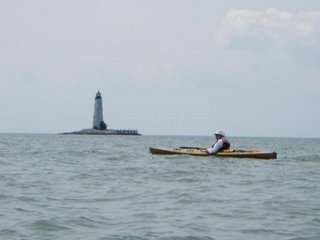
Another weekend where JP has non-kayaking obligations. So I paddle the Pamunkey river - doing the West Island/Thoroughfare circumnavigation, and explore some of the creeks.
It was a hot day, and I took a break in the river by getting out of the boat mid channel and floating for a while with the boat tethered to me with about eight feet of line. Just lying there cooling off. Had several bass boats go by, but none even looked twice at the guy in the water and the empty kayak.
The area around West Island is a very nice area. Especially up Big Creek. Paddling up on the remains of the ebb tide I saw what I thought was an animal swimming across the creek, maybe muskrat, beaver, etc. Getting up closer to it, it turned out to be the tip of the tail fin of the biggest Gar I have ever seen. It was working back and forth in the ebb current facing upstream. I paddled up alongside, and with it's snout about at my bow, the tail was at my water bladder on the front deck, making it conservatively six feet long, and swimming in about 4-6 feet of water. I watched it for a bit, then couldn't resist - I reached down with the paddle tip and touched it. Kabloom! The fish reacts, bites my greenland paddle, and takes off in a huge wash of wake.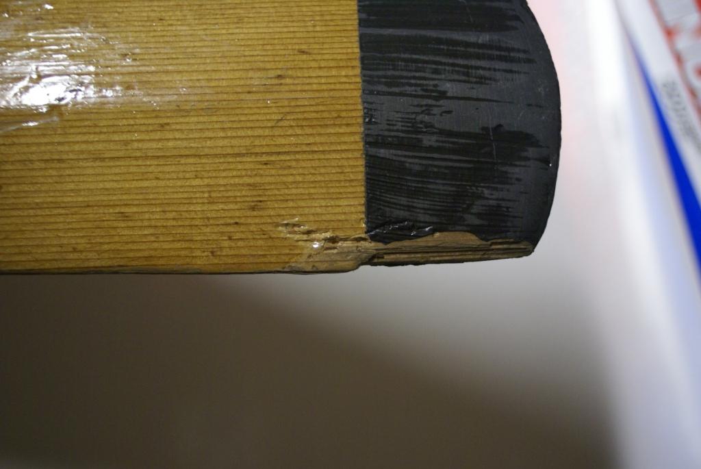 I'm upright, but looking at the tip of my paddle, which is now missing a small piece on one edge and has teeth marks in it. Guess I'll write an article for the club magazine on how to repair bitten paddles...
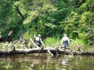
Night at Rainbow Acres, and the next day a paddle from Walkerton downstream on the ebb and back on the flood tide. Two more well timed paddle trips and I'll have done all of the Mattaponi from VA 360 to West Point. Coming back into the ramp at Walkerton ($3 to launch, owned by the Vol. Fire Dept and a very nice set of ramps), I spotted a aluminum boat coming into the ramp with me. Three nice locals, who liked the idea of me taking this photo of thier boat: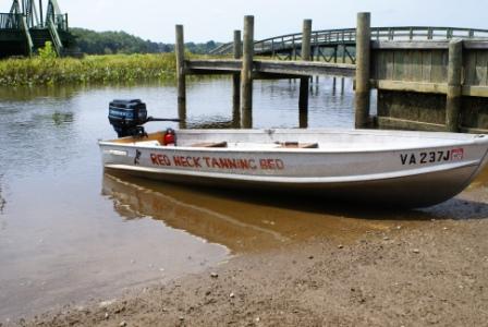 .
.
.
.
.
.
.
.
Monday, August 14, 2006 Lower Mattoponi and Poropotank rivers, VA
With JP working on her skin boat all weekend I decided to throw the camping gear in the pickup and go explore some new water. I had always heard that the Mattoponi river in VA was a strongly tidal current river, so a check on the tide charts and I was good for a launch at the mouth, heading upstream on the flood. Chris Conklin's SeMap program helped me locate a ramp across the river from West Point. A roundtrip of 25 miles had me passing several early 18th centurey homesteads and plantations, marshes, and relatively few houses. The north shore of the river, which is King and Queen County, has a couple of Va. Game Dept public ramps for use. No launches on the south side except in West Point at a busy ramp. 


A consultation of gazetteer and books and I found Rainbow Acres Campground. Mostly summer long RVers, but there is a tenting area in the woods. This would be a good place to paddle in to camp while doing the Mattaponi some time. 
Next day I met up with a fellow club member, Ellen, and we paddled the Poropotank river, which comes off the north shore of the York a few miles south of West Point. I found this in Andrea Nolan's Sea Kayking Virginia book. We launched at Tanyard landing and headed upstream at the low slack. As the tide flooded with us, we poked into the swamp, the upper end of the creek, and several side channels. Much wild rice and Ellen finally saw wood ducks. Then back down, past the put in, to explore another creek a mile or so south. Abut 21 miles of paddling and the sun was setting, the tide was in full ebb, and it was time to make the drive home.

Monday, July 24, 2006 riprap quick trip
The plan was to get out Sat/Sun into the SNP, but Saturday's T storm and rain prediction kept me local - and doubting weathermen until the storms hit Saturday night. A check of conditions near SNP and I was glad I had stayed home. Sunday I headed out, but needed to be back by noon on Monday. So, a quick loop around the riprap/wildcat/AT loop, including a swim in the creek and a night in the hammock.
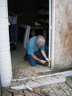
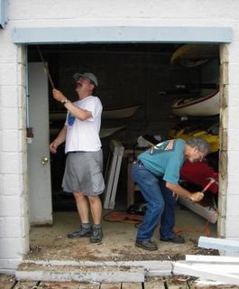
Sunday, July 16, 2006 Boathouse Door Replacement
The long promised replacement of the boathouse sliding door occurred this weekend. Having a professional remodeler with a truck full of pro-grade tools made the work go smoothly. Thanks Rich, Sue, and JP for your efforts on this! Now we need to have a contest to come up with the best way to decorate the new door. Seems like no one liked my idea of a can of white spray paint :)

Thursday, July 13, 2006 Bob Zelley's list of Recommendations for Blue Water Sea Kayakers
Bob Zelley, a very experienced local paddler, recently sent JP and I a list of "recommendations" he has compiled through his years of sea kayaking. I'm willling to bet that he learned most of these through the School of Hard Knocks. Reading through these I noted quite a few that I had also learned "after the fact".
Here is the list, published with Bob's permission:
RECOMMENDATIONS FOR BLUE WATER KAYAKERS TO CONSIDER
Collected by Bob Zelley Yard1ey, P A
~ Know what time the sun sets when you paddle; you do not want to paddle in the dark.
~ There is no better substitution for paddling improvement than time spent on the water paddling.
~ Do not depend on your equipment covering up for any short comings you have in experience, skill or physical fitness.
~ A supply of drinking water is more important to your physical well being during the first three hours of paddling than a snack
~ Except for your kayak and maybe a paddle, never put anything on the top of a vehicle as you are packing or unpacking. You will forget and it will be lost.
~ Rain hats and sun hats are not the same'. A proper rain hat is lOOt waterproof and will cause sweating on sunny warm days. After experimentation, always take one of each. Gore-Tex may enable one hat to do both jobs.
~ Carry sun block and insect repellent in an outside pocket of the lifejacket. Zippered or buckled pockets are best.
~ A nice morning can turn into a windy, cool and even wet afternoon. A long sleeved paddling jacket that is wind and rain proof should be included on any paddling trip of an hour or more. The jacket should be accessible to you without getting out of the kayak. The same is true of a rain hat, drinking water and snacks.
~ When paddling with a group, find out what their on water plans are. Paddle with kayakers whose on water interests are similar to yours. Hooking up with a group you do not know very well can produce an unpleasant and even unsafe situation.
~ Do not expect your paddle mates or other boaters to be responsible for your safety. No one can paddle your kayak for you. You cannot get out and walk if problems develop. Know your limitations. You are on the edge of you limits when fear sets in.
~ Learning and practicing self rescue and group rescues in a pool or small pond is fine. But, it is only a start. Rolling, paddle float re-entry, and group rescues most also be tested in turbulent conditions. Take advantage of warm water to practice in conditions that are most likely to cause a problem.
~ If you plan to paddle in cold water be sure your clothing will do the job. Put on your entire cold water outfit boots to hood and wade into the water. Then go into chest deep water and flop around in the water. If you feel relatively okay, no cold water shock and no leaking, you are set to paddle'. Stay close to shore just in case'.
~ Keep the inside of all water containers clean. Resist putting anything other than water in your containers. Do not use "old water". Dump out each container at the end of a trip. Do not fill fresh water book into the containers until the morning of the day they will be used.
~ When bringing a kayak to shore in a current, head upstream into the current as you beach. In doing this, the stern will not be brought around by the current.
~ Physical fitness is not a skill. Skill is not physical fitness. Neither one is experience. It takes all three to have an enjoyable and safe paddle on interesting water.
~ It has been a long day. You had a good time and you are tired. As you approach your vehicle you realize the keys are missing. This can become a horror show. I have two options worth considering. Have a key attached to the outside of the vehicle. The underside of the vehicle is a good place to wire the key in place. Another alternative is to carry the key in a zippered or buckled pocket in your paddle jacket or life jacket. The key should be carried in such a way that rolling and wet exits will not shake it loose. Do not trust Velcro closed pockets.
» Straight line paddling a problem? Have a compass mounted on the foredeck of your kayak Be sure you can read the numbers and letters on the compass while sitting in the kayak before securing the compass to the deck. When on the water, practice paddling by the compass heading.
>.. If you would not do it while paddling alone, do not do it when-paddling in a group.
Rough water, high wind., or a long crossing will get every one's attention. Few, if any, of your paddling partners will be watching you. The most one or two may be able to do is point out to the guys in the Coast Guard where they think they last saw you.
» Have a place for all of your paddling gear' at home and in the kayak. Run a visual check before leaving home. If you pack the vehicle the evening before, pack everything. Remember, "out ,of sight, out of mind". Everything has a place and everything is kept in its own place.
» Bring a watch along on all paddles. How long you have been paddling, how often you feel a need to rest, the time to start back to the put in location and when to start to look for a tent site for the night are all important. The watch must have a strap long enough to fit around the outside of a paddle jacket wrist seal or a dry suit's gasket. I have gone one better. A water resistant watch without a band is contact cemented to the outside top of my spray skirt. Whenever I want the time I just look down at my skirt.
» Knowing your average rate of paddling speed is important. Use your chart to locate easy to find features that are one to five miles apart. Paddle these distances as normal a paddle effort as you can. Keep track of the numbers with a china marking pencil. As time goes by, you should be able to establish average paddling time between many locations on your home waters.
During the first ten or twenty minutes after launching from a new location, turn around and note landmarks and water marks that you will be able to ~ upon your return. Water and radio towers, stacks, steeples, and bridges are good. choices for long distance dead reckoning. Marinas, boat shops, and the numbers on buoys are useful as you near the take out.
~ As you paddle with a group of kayakers, suppose you decide you wish to leave the group. If the group has a designated leader, tell him or her you are leaving. If it is a thrown together group with no leader, blow your whistle to get their attention and announce your plans. If you are sick you may get one or two from the group to paddle back with you. If you need towing, say so. If you and your equipment are all right and you want to do a different paddle that day, tell the group your intended plans. If you get back to the take out before the rest of the group, leave a note on one of the vehicles belonging to the group on the water announcing that you have returned safely. Never leave a group activity without notifying someone in the group.
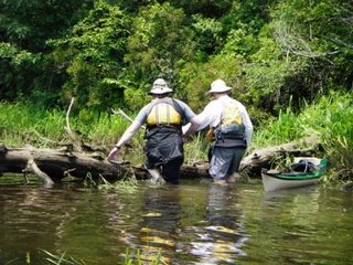
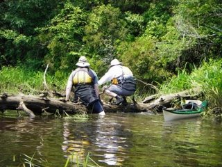
Sunday, July 9, 2006 7 days and 7 new waters
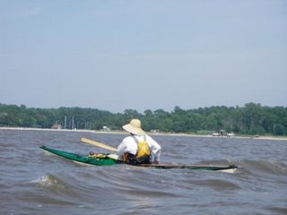
In the last nine days JP and I have paddled 7 days, and each on a piece of water new to both of us: Cat Point Creek, VA; lower Nanticoke, MD; lower Wicomico, MD; upper Blackwater, MD; Belle Isle State Park, VA; middle Piankatank, VA; and new portions of Winter Harbor, VA. Select photos:
Woody and I take the immediate method of solving the kayak blocking blowdown problem:


Thursday, June 29, 2006 Back to the original idea, almost
A long time ago I was working on wildlife photography as a hobby/possible second career. That led to sea kayaking, and eventually to getting several articles and photos published in magazines. I hadn't gone back to the writing/photography scene in quite a few years. However, a recent foray back into the field in a minor way did manage to get some writing and photos published in the August issue of Sea Kayaker. Personally, I was pleased that I could still work at that level of competence.
Thursday, June 22, 2006 Good Friends leaving, but won't be forgotten
Our local paddling group thrives because of the people who volunteer their time and efforts to keep it running, providing food, leadership, help, and friendship. Two of our best are moving out of town, but they won't be forgotten. Going away cake: 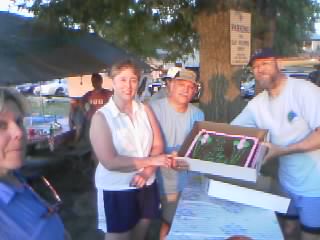
While searching through my sea kayaking literature bookshelf I came across the notebook holding old editions of the Chesapeake Paddlers Association Newsletter, The Chesapeake Paddler. Some of those articles are still enjoyable or educational to read. From time to time I'll post some here for download. The first one is ready at http://mysite.verizon.net/gdwelker/id48.html
Thursday, May 11, 2006 Kayak Launch Site Website
Here's a useful website for finding kayak launch sites in the MD/VA/DE area:
http://www.hi-techboats.com/Page14_KAYAK_PADDLING_SITES_all.html
Sunday, April 30, 2006 CPA SK102 2006
The yearly SK102 skills training weekend by the Chesapeake Paddlers Association was held this weekend. 90 some students, 30 some instructors, and 85 degree F water at Lake Anna. JP and I did instruction - greenland paddling, rolling, strokes, kayak design, rules of the road, and kayak gear.

Tuesday, April 25, 2006WhiteBlaze - an Appalachian Trail Community
WhiteBlaze is a website about the Appalachian Trail, thru hiking, backpacking, etc. A very good source for local information on backpacking in the east, and for information and opinions on gear.

Sunday, April 16, 2006 Assateague Island kayak camping April 14-16, 2006
An extended weekend with great weather found JP and I at Assateague Island's paddle in campsites with a friend and his daughter. Temps of 50s at night, and 70-80 in the daytime, with wind that was low velocity for Assateague norms. A few ticks, but no bites. Terrapins, Bald eagles, herons, egrets, ponies, etc. JP had her digital camera:
Saturday, April 1, 2006 Doyles River Overnight
A short circut using the AT, Doyles River trail, and Jones Creek trail allowed me to get the second March overnight in. Great hammock weather. The waterfalls were interesting, although the water levels were signficantly lower than a normal spring. I saw no one else on the trails. Wildlife: very large stag, grouse, opossum, and one very scared racoon who sniffed my pack at night, and then suddenly realized I was ABOVE him in my hammock!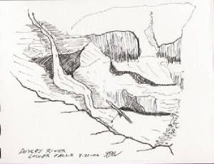
NOAA integrates free BookletChart for the Chesapeake with the Notice To Mariners
A while ago on the cpakayaker listserve there was discussion that boaters, even casual ones, had the responsibility for knowing, understanding, and keeping current on the nautical rules of the road, exclusion areas, etc. It was pointed out that the changes are published in the Notice to Mariners which is updated just about weekly on the web.
Also, a while ago, I posted about NOAA now providing free booklet charts for the entire Chesapeake Bay area. These are free, downloadable to your PC, and can be printed on standard 8.5 x 11 paper.
Now, NOAA has incorporated the Notice to Mariners into the BookletCharts, which will be updated weekly to include all the notices in effect.
The NOAA bookletcharts are available via www.NauticalCharts.gov/bookletcharts
Sunday, March 26, 2006 AT hike today
After a day at home yesterday - JP working on her skinboat and me outback aerating the yard with the atlatl and darts, we took a hike on another part of the AT today. Quiz for today: What connections exist between Bowie and this rock?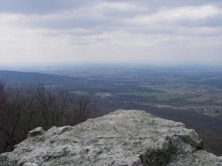
Saturday, March 25, 2006Navigation Quiz
About two years ago the navigation class that I was supposed to teach at our club's kayak class weekend was rained out. So I put together several navigation related questions and posted them to the CPAKayaker list serve. I was recently asked if I still had them around, so here they are:
Ok, so the navigation and rules of the road classes got washed out at LakeAnna this year. If you would have attended, you would know that aides tonavigation come in different colors:
Question #1
Cans, which mark the port side of channels, are green.Nuns, which mark the starboard side of channels, are red.
Some aides are green and red, marking branching channels.
Aides that are white and red mark safe water.
Aides painted black and red mark isolated dangers.
Yellow is for special use.
But do you ever see blue on an aide for navigation?
Answer #1
Yes, those are the two applications of blue in the US.
One is the Francis Scott Key Buoy is shown at approx 39 degrees 13 min 30 sec lat x76 31 30 long, just north of the spot where the key bridge crosses the FortMcHenry channel. It is labeled on most charts as N Bu R W, which means Nun,Blue, Red, White.
Question #2
When we go to paddle across a river or channel, or a lake, we generally pickan object on the far shore to paddle toward. If there is no wind and nocurrent, and we paddle straight, we will arrive at the object we picked viathe shortest distance from our starting point. However, in real life thingslike wind, current, waves, and other factors can cause us to paddle a coursethat is not a straight line from start to finish. One of the methods toinsure that you are paddling in a straight line to your destination is touse ranges.
A range is when you can see one object at your destination point, and canalso see a second object DIRECTLY behind the first object. As long as youare able to paddle toward the first object and keep the second object linedup directly behind the first, you are paddling the shortest possible courseto your destination. For example, let us say that you want to paddle acrossthe Potomac river from the Maryland side. On the Virginia shore you can seea white house along the shore. By shifting a few yards one way or anoher youcan get a water tower to line up directly behind the house. Now as long asyou paddle your kayak so that the water tower stays directly behind thewhite house you will be paddling the shortest course to the white house fromyour starting position on the Maryland side. The farther the distancebetween the two objects that you are using as ranges, the greater accuracyyou will be able to maintain on your paddle toward your destination. If thewater tower is only 200 feet behind the white house, your course will not beas accurate as it would be if the water tower was 1000 feet behind the whitehouse. When picking objects to use as ranges, try to pick one object atyour destination point and try to find an object on the horizon to use asyour second point. This may mean shifting your starting position a hundredfeet one way or another to begin with, but it will shorten your overalltrip. Near objects can be buildings, docks, or a tree. Far objects can beradio towers, water towers, smokestacks, or the notch of two hills or mountains.
When using a range, you will sometimes find that the second object willappear to move out from behind the first object you are sighting on for yourrange. This means that you are no longer on the direct route to your firstobject and need to correct your course. In our example of crossing thePotomac from Maryland we made a range of a white house with a water towerthat lined up directly behind the house. If, as we paddle across toward ourdestination, the water tower appears to move out to the right of the house,do we need to paddle to the left or to the right to correct our course andget the house to line up with the water tower again?
Answer #2
To get back in line with the range that we have established using the houseand water tower we would have to paddle to the left. This would put us backin line with the two objects we are using for a range and allow us tocontinue our paddle as planned. Our drifting out of alignment was probablydue to wind, waves, or current. To stay in alignment with the rangeobjects, we will need to angle to kayak slightly into what is causing us todrift. Your kayak will now be pointing slightly to one side of the rangeobjects, but you will be travelling toward them. The angle between thedirection the kayak is pointing, and the direction of your intended courseis called the ferry angle, which you may have seen discussed in some of theposts about Navigation Question #2 last week.
QUESTION #3:
Before setting out on your trip, you can actually calculate what the ferryangle would be in general situations.
Let's say that the potomac crossing is six miles. You can paddle at 3 milesper hour. You know that the incoming tide will have a predicted speed of 1mile per hour during the time you will be on the water.
Take a compass sighting on the range made by the two range objects weselected by using your deck compass. Point the kayak at the range. Readthe compass. Let's say the compass heading is 270 degrees. Note that thiscompass reading is when you, the house, and the water tower are all in linewith each other and the boat is pointing at the range objects.
Paddling at 3 miles per hour, you will be on the water for two hours.
The current, at 1 mile per hour, will push you upstream (directly north) twomiles if it takes you two hours to do the crossing.
If you start paddling directly toward your range objects you will end up inVirginia two miles upstream of your range objects, and have to paddle twomore miles than your planned six to reach the Va. landing point. You needto compensate for the tidal current.
On your chart, draw a line from your Md. starting point (label this point A)through the two range objects you will use. Where the line intersects theVa shore label this point B. Draw a line perpendicular to line AB throughpoint B. Measure this line to find a point two miles south of your line ABacross the potomac. Label this new 2 mile point as C. You now have twosides of a triangle. Complete the triangle by drawing a line from C to A.The angle that is between the lines AB and AC is your ferry angle. This isthe angle that you need to keep the bow of the kayak pointed in to cross thepotomac along your intended course of AB.
This angle is slightly less than 20 degrees. Round it off to 20, sincecompass navigation in a kayak is rarely more accurate than plus or minusfive degrees. Your course from Md to VA along the range line was 270degrees by the compass reading. Subtract 20 degrees from this to get 250degrees. As you paddle across the potomac, you should keep your boat angledto read 250 degrees on your deck compass, and keep your boat in line withthe two range objects. This will get you across along the line AB.
That's the theory. Real life is a little different. Wind, tide, current,and waves vary and our 250 degree heading is a best guess before startingout. Still, I'd rather use a best guess than find myself two miles awayfrom my intended landing point! In practice, I always try to end upslightly "above" my intended landing point. In this case, since the currentis pushing me toward the north, I'd like to end up over near the Virginiashore slightly south of my landing point and be able to drift down easily toit, than paddle against the tide. This is particularly important ifpaddling against wind and waves. It's demoralizing to make a bumpy crossingonly to find that you now have to paddle against the wind and waves to getto where you were trying to head in the first place. As you paddle across,keep an eye on your compass and the range, and adjust your angle andpaddling speed as needed.
Back to theory. Given:
Compass heading to the va shore from md is 270.
It is 6 miles from MD to Va.
Paddling speed is 3 mph.
There will be incoming tide for the first 1/2 of the trip.
Incoming tide will be 0.5 mph heading north.
There will be outgoing tide for second 1/2 of the trip.
Outgoing tide will be 1 mph heading south.
What should your compass read as you paddle across?
Hint #1: The range will tell you when to change.
Answer #3
On your chart, draw a line from your starting point in Maryland to youranticipated landing point on the VA shore. This should line up with thehouse and water tower we are using as ranges. This is line AB, A being onthe Md shore.
Since the tidal current will change half way through the trip, mark a pointhalfway along this line. This is point C.
For the first half of the trip, the tidal current is going upstream at 0.5mph. Trip length is 6 miles / 3 miles per hour = 2 hours.0.5 mph current x 1 hour (halfway) = 1/2 mile for how far the tidal currentwill try to push you upstream.
Draw a line perpendicular to your planned range route from the halfway point.Measures off 1/2 mile DOWNSTREAM along this line.Mark this point. This is point D.
Use your NAVAID to calculate course along this line from point A to point D.This would be your ferry angle compass reading to hold for the first half ofyour trip.It should be about 260 degrees.
The tidal current will change at the time you are in mid river and beginflowing out. It will flow out at 1 mph.
From point B on the Md shore, draw a line perpendicular to line AB.
Outgoing tide of 1 mph x 3 miles distance / 3 mph paddling speed = 1 milecurrent push downstream. You will need to compensate for the current by aiming 1 mile upstream FROMYOUR POSITION AT THE TIME THE CURRENT CHANGES. This is important.Let's assume your have done all your calculations and paddling correctly,and that the current for the first half of the trip was as predicted. Youshould be at point C in your kayak.
Measure 1 mile upstream from point B along the line perpendicular to AB.Call this point E. Draw a line from point C to point E. This is your newferry angle course. It should be about 290 degrees.
In theory, you will paddle off the Md shore using a ferry angle compassreading of about 260. Halfway through your trip, when the tide changes, youwill change your ferry angle course to be 290 degrees, and end up at yourdestination on the VA side.
Why did we do this navigation calculation along a route that had a range?
The range will act as a double check for our ferry angle caculations andwill tell us when the current changes. As you paddle along, keep checkingthe range. Adjust your planned ferry angle to keep the range in line. Thiswill compensate for errors or variations in the tidal current data, and windeffects. As you reach the point where the current begins to reverse, therewill be a period of slack current, and then the reverse current will beginto occurr. Keeping your range will allow you to compensate for these periods.
As a good general rule, never rely on only one way to navigate. In thiscase, the range acts as backup to the ferry angle calculations you made.
Question #4
How fast do you go in your kayak? This is a question to ask whether you areracing or just out for a casual paddle. If you know the answer to thisquestion, then you will start to be able to apply the principles of deadreckoning to your kayak trip planniing and navigation.
In marine navigation, distance is measured in nautical miles (NM), which are6,076 feet, or about 15% longer than a statuate mile as measured in yourcar. Time is measured in minutes and hours, and speed is measured in knots.One knot equals a speed of one nautical mile per hour. The formula lookslike this:
speed = distance/time
If you paddle 8 nautical miles in 4 hours, your speed would be:
8/4 = 2 knots.
How can you figure out your typical paddling speed? Some of us keep logs ofour kayak trips, where we record the duration of the trip, and the milesthat we covered. You can measure the miles off of a chart after you gethome. You can keep track of the duration by using the stop watch functionon most digital watches. Whenever Jenny and I paddle, we start ourstopwatch functions when we are both on the water at the launch point. Wekeep the watches running through lunch stops, water, and shore breaks. Whenwe return to the launch point at the end of the day we stop the watches.Over several trips this gives us data that may look like this:
5/14/00 10 miles 4.3 hours
6/3/00 14.5 7.0
6/11/00 11.0 4.5
Over these three trips, we have paddled 35.5 miles in 15.8 hours. Ouraverage speed, including breaks, was 35.5/15.8 = 2.25 miles per hour, or 2.3knots. As we add more trips to the list, our calculation of average speedfor the two of us paddling becomes more accurate. If you know your averagespeed you can figure out how long it will take you to paddle somewhere. Sayyou want to launch from your favorite put in and paddle across to a countypark. You measure the distance from a chart, and it is 10 NM. 10 NM x 2(you have to get home) = 20 NM. 20/2.3 = 8.7 hours of paddling. Can youpaddle for almost 9 hours? If not, doing this bit of math just saved youfrom a really long paddle back to your launch point.
Let's say you shorten the trip to a closer lunch spot that is only 6 milesaway. Roundtrip is now 12 miles, and will take 12/2.3 = 5.2 hours. Thislooks reasonable for many people. It's good to know the estimated durationof a trip before you start out for several reasons. Of course, there arethe dinner reservations you made, and perhaps you prefer to get back to thecar before dark.
If you keep track of your lunch break times, you can add another importantbit of data to your personal paddling navigation. Let's assume that on thethree trips listed above each had a 30 minute lunch, and no shore breaks.Our on-water speed is now:
35.5/14.3 = 2.5 knots.
What can you do with this information? Remember problem #3 where we wantedto paddle across a 6 mile wide river and we knew our paddling speed was 3knots? If you know your on-water paddling speed you can figure out how longit will take to get from one point to a second point. Note that thison-water speed includes any breaks you take on the water to drink, rest, etc.
Paddling from Pier 7 to the Thomas Point Lighthouse is about 7 NM (don'tquote me on that). If my on-water paddling speed is 2.5 knots, and sunsetis at 7:00 pm, when do I need to launch in order to get back by sunset?(Don't worry about currents or wind)
Answer #4
To find the answer:
7 NM x 2 (it's a round trip) = 14 NM total
2.5 knot speed
14/2.5 = 5.6 hours
5.6 hours = 5 hours 36 min.
7pm - 5 hours 36 min = 1:24 pm.
You need to launch by 1:24 pm.
Question #5
In Question #4 I explained how to use the speed/distance/time formula tofigure out how long a trip, or segment of a trip would be. This informationcan also be used to help you figure out where you are at any point on your trip.
If you have an typical paddling speed on the water of 3 knots, you know thatyou will probably travel 3 nautical miles in one hour. So if you and afriend launched your kayaks from Pier 7 on the South River and paddled downthe river for an hour, you can figure that you have probably paddled 3nautical miles. This is a ballpark estimate of your location on the river.If you know what the tidal current is doing at the time of your trip, youcan increase the accuracy of your estimated position by adding orsubtracting the tidal current velocity to your paddling speed. So, if thecurrent is going out (ebbing) at 1/2 knot at the time you are paddling, youwill have travelled this distance:
1 hour x (3 knots paddling + 0.5 knots current) = 3.5 nautical miles fromyour starting point.
If the current was coming in (flooding), your distance would be figured as:
1 hour x (3 knots paddling - 0.5 knots) = 2.5 nautical miles from yourstarting point.
If you have a record in your log book of the effects of wind on yourpaddling speed, you can add or subtract the wind effect in thesecalculations. Note that a 15 knot wind does not move you in your kayak at15 knots! Let's say your records show that a 20 knot headwind reduces youron water speed to 1.5 knots. Our distance paddled for one hour with a 20knot head wind and an ebb tide of 0.5 knots would be:
1 hour x (1.5 knots paddling speed in 20 knots headwind + 0.5 knots current)= 2 nautical miles.
This system works well on a small river or following a shoreline, but it isstill only an estimate of how far you have travelled, and where you may be.When I wrote about using a range to help cross a river, I also used acompass heading. The two methods, which work independantly of each other,give me two different ways of navigating on my course. The same idea of twoindependant methods also works when trying to figure out where you are.Method #1 is the speed/distance/time formula discussed above. Method #2 isto determine your position by the use of compass bearing fixes.
Let's say you've been paddling along, and slowly realize that you're notquite sure where you are. You know your speed/time/distance information,but that only tells you how far you have paddled, not in which direction.You look around. You see a lighthouse, a green navigation aid marked "41"and a green aide marked "1MH". Assuming you have a deck mounted compass,point your boat at each item and note the reading on your compass. This isyour bearing to each item. You have:
lighthouse: 240 degrees
green 41: 90 degrees
green 1MH: 0 degrees
Get out your chart plotting device. You should be able to figure outroughly where you are on the chart and find the three objects on the chartthat you see around you. If a person was on the lighthouse looking at you,they would read a compass bearing that is called the recipricol to the oneyou read looking at the lighthouse. Think of it as the reverse of thenumber that you read when looking at the object. To find a recipricol, addor subtract 180 from your bearing. You add 180 if the bearing is less than180, and subtract 180 if it is more than 180. (Frankly, I just think of itas what is on the opposite side of the compass from me). Here's therecipricols:
lighthouse recipricol: 240 - 180 = 60 degrees
green 41 recipricol: 90 + 180 = 270 degrees.
green 1MH recipricol: 0 + 180 = 180 degrees
Now, you can draw a line from each of these objects using the recipricols.If you do this, the three lines from the objects should form a triangleinside the larger triangle formed by the three objects. You are probablysomewhere inside or very near that small triangle. The more accurately youdo each of the steps involved (taking the bearings, drawing the lines) thesmaller the triangle will be, and the better idea you will have of exactlywhere you are. Here are some hints on how to get better accuracy:
1. Whenever possible, pick objects that surround you. In this example, wehad objects north, east, and southwest of the kayaker. If you don't havethis, try to pick objects that are not all close to each other. The fartherthe objects are from each other the better your accuracy.
2. Pick objects that are discrete. Pick navigation aides, radio towers,water towers, the center of bridges, etc that are shown on your chart. Trynot to use hills (hard to define where the top is on the chart), points ofland (if you're really lost, they often all look the same - especially inthe Chesapeake), or groups of buildings.
3. The farther the object is from you, the greater the accuracy of yourcompass reading.
4. Take all of your bearings, then do the math and chartwork. This willhelp keep drift error smaller than if you take one bearing, calculate andplot the recipricol, and then do the next. Between bearings you may bedrifting.
Now, remember I mentioned using two methods independantly? Is the locationyou just plotted in rough agreement with your speed/distance/timecalculation? If you plot your location as 10 miles from your start point,and your speed/distance/time calculation says you've travelled 3 miles, oneof the two is definitly out of wack. Recheck each. If they still do notagree, and the difference could not reasonably be due to wind or currenteffect, you are not out of luck yet. There is at least one thing you andand your buddy in your kayaks can do to try and figure out where you are.Assume you each have only a compass, chart, plotter or Navaid, and don'twant to paddle any more than you have to in order to determine yourposition. What can you do?
Extra credit for the experienced navigator and navigation geek: what is theheight of the lighthouse?
Answer #5
Possible things to do to verify the accuracy of your position fix:
1. Get both boats side by side, about 3 feet apart, and both aimed at oneof the objects on which you can take bearings. Each paddler shouldindependantly read their boats' compass. Do the two numbers agree to within5 degrees? Repeat for the other two bearing objects. Do the bearings fromone of the compasses make more sense than from the other compass? If so, itis likely that the one compass is in error - either it is broken, or thereare ferrous or electrical items packed nearby it in the boat that areaffecting its performance.
2. Are both charts the same? Jenny and I often paddle with two differentmakes of charts or maps. Often one chart will show details that the otherdoes not. For instance, we have used marine charts in conjunction with MDEfishing charts; or marine charts in conjunction with topographic maps.Also, check the reference dates of the charts. Use the newer chart!
3. Put a greater reliance on the objects that can change the least.Lighthouses are rarely relocated by man or mother nature. On the otherhand, buoys and day marks may be relocated by man, ice, or storms. BrianBlankenship and I paddled the Core Banks area of North Carolina severalweeks after the hurricane passed through the area and noticed that manybouys were well off their charted positions, if they could be found at all.In question #5, I would place a greater reliance on the location of thelighthouse than any of the other bearing objects.
>>Extra credit for the experienced navigator and navigation geek: what is the>height of the lighthouse?52 feet. There is only one spot on the bay where this combination oflighthouse and navigational aides exist.
Sunday, March 12, 2006Cold Mountain, Virginia Backpacking
Three days before the weekend I had a choice to make - go to the kayak club trip planning meeting on Saturday, or go take advantage of the predicted 70 degree weekend temperatures and go backpacking. When I learned the trip planning session was at noon on Saturday, which was going to deprive me of being outdoors both days (I had thought it was Saturday night) the decision to go backpacking was the obvious choice.
I chose the loop formed by the AT trail over Cold Mountain and the Hotel Trail which comes back along the eastern side of Cold Mountain. After the climb to the top of the mountain, the AT travels across about a mile of balds (wide grassy areas with no trees) with spectaular views.
It was a great spot to eat lunch, read a book, and watch the scenery. Unfortunately, it was also very sunny and I had just gotten a short haircut - and now had the first sunburn of the season. A nice night in the hammock using the WM Apache bag and the CCF pad (High 72, low 59). I had planned for the catabatic winds with my hammock pitch, and slept well. A couple of sprinkles during the night, but not enough to wet things down. Day two was an easy hike back out on the hotel trail, past a couple of possible future campsites.
Monday, February 27, 2006 Three Ridges, VA backpacking trip
 This weekend was a loop hike of the Three Ridges Wilderness area in Virginia. the trip took us up and across the peaks or ridges of the area, totalling about 1900 ft of climb on day 1 and 1800 ft of climb on day 2. Total horizontal distance 12.2 miles.
The night found us camped at a nice stream, with a campfire at the AT shelter, then off to our sleeping arangements: 1 tent, 1 hammock, and 1 tarp. Low that night of 21 degrees, with wind gusts. All slept warm. R. used a truck windshield screen, thermorest camp chair,
space blanket and butt pad with a zero degree synthetic bag in the hammock. I used byt 15 degree Western Mountaineering Apache SMF bag, with tights and fleece pants, thermal top, and down jacket and beanie under my tarp. Part of the night the wind blew up the valley and directly into the tarp opening.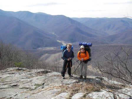
Day 2's hike out was up a tumbling stream valley - very nice, and a likely future camping spot during the summer.
.
.
.
.
.
Thursday, February 23, 2006 Broken paddles and carrying spare paddles
The breakage of an expensive graphite lightweight paddle at a recent practice session generated some discussion cpakayaker recently (http://www.cpakayaker.com/forums/viewtopic.php?p=2902#2902 for the thread), prompting me to put a few thoughts down on broken paddles and why and how to carry a spare paddle.
One of the issues with any type of cutting edge technology product, such as graphite/carbon paddles is that the margins of error in the manufacturing process are often not well understood or defined. And I've never even heard of an engineering design guide standard for paddles.
In the quest for weight savings, we need to be cognizant of what we are potentially giving up. It's like light beer - it can't be less filling and still taste great. When you buy a very lightweight paddle you should understand that you are giving up some of the strength that would be in a heavier paddle of the same material. Over the years I have seen numerous graphite/carbon paddles break - always in the shaft away from the ferrule. As Woody noted, all of the breaks I have seen have been catastrophic - no warning signs. I have also seen several wooden paddles of euro and greenland design break. Wood is a material with inherent inconsistancies in its structure (such as knots and grain) and a well made wood paddle minimizes these inconsistances, but again, just like a graphite paddle, the closer you push the limits on weight the less margin of safety you have for possible breakage. I have yet to see a glass paddle break in the shaft. I have seen one very light glass paddle break in the blade when the extended grip was used and the paddler didn't know how to properly brace. Perhaps backup paddles should be glass.
Last year I experimented with building a number of foam and graphite paddles. I could come up with very very lightweight paddles, but I pushed the margin too close on them, and they all (except one so far) have ended up failing - almost always catastrophically. In the case of one paddle, I was surfing along on a wave, dug down with a stroke, and suddenly realized the lower half of the paddle was missing. Surfing the remainder of the wave with the short half of a paddle was invigorating! But, as always, I was carrying a spare paddle and was able to finish the trip using the spare.
I have one wood paddle that I made out of an extremely light piece of cedar. The paddle is a joy to use, but the lower the density of red cedar the lower the breaking strength. I would not trust that paddle in surf or rough conditions. It only comes out for calm protected paddles, and as always, I carry a spare paddle.
How close you cut that margin of safety is a personal decision, but you need to be cognizant of the consequences, which, in this case, could include the breakage of a paddle at a very awkward or dangerous moment.
I have mentioned the idea of carrying a spare several times, and it has been referred to in some of the posts in this thread. My personal rule is to always carry a spare on any kind of trip. But simply carrying the spare paddle is not enough. You need to be able to get the spare out of the stored location on your boat while you are on the water, in your cockpit, and by yourself. I look at many of the spare paddle storage setups on manufactured boats and can not figure out how I would get the spare out while on the water without someone paddling up to me and doing it for me. Some of these storage positions are too far toward the stern of the kayak to be reached from the cockpit. Many storage systems are rigged for the paddle blade to be the end of the spare paddle nearest the kayaker. I have tried to use spare paddles from positions where the blade is closest to the cockpit, and have either been unable to get the paddle, or had difficulty. This is especially true when the euro paddle is stored so that the tip of the blade is curving down to the deck and not up away from the deck - there is nothing to grab to get the blade, especially if you are wearing gloves for cold water.
My strong preference is to carry the spare take apart paddle with the shaft ends toward the cockpit. I have practiced getting my spare paddle out from this position and can do it easily from on the water, and from an upside down position to roll up with half a paddle. I suspect that for most people the best place to store a spare paddle is on the deck IN FRONT of the cockpit with the shaft ends facing the cockpit. This would eliminate having to turn around to get the paddles - often an area where you can not see what you are doing and are relying on feel. However, most of us, myself included, carry a bunch of other stuff on our front decks, precluding keeping the paddle here unless it's a greenland paddle.
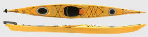
The photo above shows a sea kayak with rear deck rigging that almost forces you to store your spare with the blades toward the cockpit, and the shaft ends going under the two bungee sections aft of the rear hatch. People then turn the blades downward so they don't dig into their backs when rolling, making it harder to recover the spare blades.
 This sea kayak is rigged to more easily allow you to store a spare paddle with the shaft ends toward the cockpit. The blades slide under the set of bungees to the rear of the aft hatch (stern on this kayak is to the right - stern on the previous photo is to the left).
At this point I get to put in a plug for carrying a greenland type paddle. The greenland type storm paddle is shorter than the standard greenland paddle, and will fit on most kayak stern decks without significant overhang of the stern. Carrying a storm paddle as your backup allows you to grab a paddle that is already assembled and ready to paddle with when you need it. Can you assemble your take apart paddle while bouncing around in bad conditions? Can you roll up using only half of your take apart paddle? If you know how to roll, you can roll up with a storm paddle almost as easily as with a full greenland paddle, and we know rolling with the greenland is easier than the euro.
End of greenland plug.
Spare paddle don't need to be the same model you normally paddle with, and can definitly be less expensive models. My first spare paddle was a sevlar screw apart kayak/raft paddle - but at least I had a spare! My second one had a metal shaft and plastic blades - but I had a spare!
Oh yeah, and when was the last time you put together that spare paddle and actually paddled with it?
Wednesday, February 15, 2006 Site Migration - Starting Now
I've run up against the limit of the 10MB of free server space that came with my dsl subscription with Verizon. I've started to teach myself real HTML coding, and have begun to move portions of this site over to a new site at:
http://welker.atspace.com
The new site has 500 MB of free server space, so if you'll bear with me in the move, the new site will eventually allow me to post larger and more photos, and include much more information about the topics.
However, until I figure out how to move my blog over there - and make it as easy to upload to as this site, I'll be keeping the blog at this location.
Sunday, February 5, 2006Assateague backpacking, cold weather hammock, WM apache bag
Spent the weekend backpacking at Assateague http://www.nps.gov/asis/ Four of us on the trip, two trying minimal gear. I slept in the cold weather hammock and 15 degree bag with fleece clothing. Low of 43 with 20 knot winds that shifted around and spent the night blowing right through the open ends of the tarp. I felt like I was sticking my head out of a car moving about 20-30 mph - I woke up with my eyes tearing, but plenty warm. Very pleased with the WM bag. First time in a compression bag and worked very well on relofting in about 5 min.
Wednesday, February 1, 2006 More cold weather hammock experiments
Slept out last night in the latest incarnation of the cold weather hammock setup. Worked very well at a windy 38 degrees F.
Monday, January 30, 2006 Western Mounteering Apache Super MF sleeping bag
I've started the testing and review of the that I got on sale recently. More testing to come in the next week or so.
Sunday, January 8, 2006 Assateague Backpacking in January
I got up Saturday knowing I really didn't want to hang around the house for the weekend. Jenny wanted to work on her skin boat project, so I checked the weather and loaded up the backpack and headed for Assateague.
Backpacked into one of the beach sites, and spent the night under the stars. Saw loons, and a surf scoter on the way in. And the obligatory ponies and sitka. It was a great sunset. Used the bivy bag, winter sleeping bag, and the tarp from the Hennessy. Lots of condensation when the fog rolled in, both inside the bag and out, and the underside of the fly, which then froze as the temps dropped to 27.
A nice quick night in the woods to start 2006!
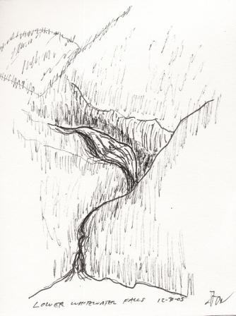
Sunday, January 1, 2006 South Carolina Mountains and Foothills
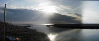
I just got back from a couple of days of hiking in the South Carolina foothills and mountains around Clemson. Life isn't too bad if on the last day of the year I'm hiking in a t shirt in beautiful mountain scenery on the Foothills trail : http://www.foothillstrail.org/ Here is a five minute sketch of Lower Whitewater Falls:
Friday, December 16, 2005 Thoughts on kayaking watches.
I wrote this in response to a friend looking for a kayaking watch:
I got the Weather Pro watch from Speedtech for Xmas one year:http://www.speedtech.com/asp/product.asp?product=73&ph=search&keywords=watch&recor=1&SearchFor=any&PT_ID=all
Tells wind speed peak, average, in knots, m/s, mph.
Barometer - variable units of measure, with nine your history trend (good for predicting weather changes)
Altimeter - variable units of measureAlarms - multiple.
Stopwatch - normalSail race countdown timer
Normal countdown timert
emperature - variable units of measure.
Compass showing magnetic north.
Works on wriststrap or lanyard
From my experience, very waterproof and pretty rugged. A little bulky. Bright backlight that I've used on occassion as a flashlight in my sleeping bag to find things. Wind meter is pretty accurate.Only downside is it eats a battery a year. The company has a very good reputation for service and product reliabilty in the sailing community and from tests in Practical Sailor.
I refer to it as my "spy kids" watch :)I've had a couple of expensive watches sink into the deep blue sea when bands broke during rescues, so you do need to ask yourself what your risk/cost ratio is in this situation.What do you want a kayaking watch to do? Here is my list of must haves:
1. Timer/stopwatch. I like to keep track of time on water, time of trip legs, etc.
2. Countdown timer. Good for a number of things - naps, lunch breaks, timing a distance/time navigation run. Snooze alarm.
3. Waterproof. Read the specs. Some I've looked at are only waterproof if you don't push the buttons while they are underwater or wet. that won't work for me.
4. Non rusting. The fewer metal parts the better - stainless or otherwise.
5. Able to be read in the dark - all functions. Whether by backlighting or Indiglo.
My thoughts on temperature functions - useless in most cases except: 1. At camp to see how cold it is. 2. with watch fastened around paddle shaft and stuck down into the water a couple of feet and held there for about ten minutes to detect water temps. Most of the temperature functions of the watches I have seen have a really slow sampling rate - some 1 sample ever 5 or 10 minutes, others only when you push a button. The temp is not accurate if the watch is wet and exposed to wind, or under a coat, etc. Many watches also use a bimetal band of metal that by flexing register the temperature. These, if exposed directly to the water, may rust.
Tide guages I have seen only account for tide at one location. You will still need to look up the variance from place to place as you travel in your kayak, and remember the offsets from the location you set for to the location you are paddling. I had one watch with a "tide ring" on the bezel that you could set. that did not work particularly well.
I go to a chain discount store, find a timex or casio in plastic that has functions 1-5, and usually pay under $50. My current one is a Timex Atlantis 100. I still have a Timex Reefgear that survived for many years (has temp) that finally lost one of the buttons, but is still watertight and workable.
Friday, November 18, 2005
Test #1. 11/18/05. Hung the HH with underquilt under the deck at home. Equipment used: HH hammock, Kelli's underquilt, REI zero degree synthetic sleeping bag, Pickup truck windshield reflector placed between the quilt and the hammock, silver side up. Wore midweight fleece pants, and expedition weight thermal top. Light fleece balaclava. Low temp of 30 degrees. Wind of 0-5 mph. Slept warm. Slightly less warm at my one calf - legs were pointed in the direction of the wind. If I leaned against the upper sides of the hammock, they were cold above the underquilt level. Future underquilts should rise higher along the sides of the hammock.
Sunday, October 23, 2005 Best quote of the weekend:
"Well, I guess drownproofing myself is a better use of a Saturday night than sitting in some smokey bar..." From the kayak rolling session.
posted by Greg @ Saturday, September 09, 2006
![]()
![]()

0 Comments:
Post a Comment
<< Home